[The following is the text of the annual EGR Taylor lecture which I delivered at the Royal Geographical Society in 2019.]
When we think of navigation, what typically springs to mind?
Maps and charts, compasses and sextants, and today of course the marvel of GPS. In other words, technical navigation.
But there’s another kind of navigation - which sometimes goes by the name of ‘wayfinding’. The ability of animals, large and small, human and non-human, to find their way without the help of any tools - apart from their senses and native wits. That’s what I’m going to be discussing tonight.
Let’s call it animal navigation.
Animal navigation is a big and complicated subject so I’m going to focus tonight on just one important aspect of it. How our fellow creatures make use of the light of the sun, moon and stars to find their way.
That animals - even ones as apparently simple as insects - can do such things, may come as surprise. But it should not. After all they face the same navigational problems as we do, and have access to the same sources of information. That they have found such good solutions is a tribute to the immense power of natural selection.
By the end of the evening I hope you will share my sense of wonder at the extraordinary abilities to which the evolutionary process has given birth.
But I want to start by saying a very few words about EGR Taylor - in whose memory I am delivering this lecture.
The first point to make is that, concealed behind those initials - EGR - was a woman. In fact Eva Taylor was one of the first women in the UK to storm the ramparts of what was then an exclusively male academy.
She was born in 1879 and took a degree in chemistry before shifting her attention to the study of geography. She never married, but raised two children during and after the first world war. She made ends meet by lecturing but rose eventually to become the first female professor of geography ever appointed in the UK - at Birkbeck in 1930. She retired in 1944 but continued working almost until her death in 1966.
Eva Taylor was, among other things, a leading expert on the history of marine navigation.
I first came across her work when researching my last book, Sextant, which is in part an account of how the longitude problem was finally cracked by the combined efforts of astronomers, mathematicians and instrument-makers in the mid-18th century. Please note: it was not the single- single-handed achievement of John Harrison!
Taylor’s classic study, poetically entitled The Haven-Finding Art, appeared in 1956 and, though long out of print, it’s a bible for anyone interested in the story of how human beings have solved the problems of navigating at sea. It’s also a very good read.
When I was writing Sextant I began thinking about the deep history of navigation. How did animals find their way around before human beings appeared on this planet?
I already knew a little bit about this from studying animal behaviour at university, but when I started to research the subject I quickly realised it had moved on a very long way.
I’ve spent the last three years writing a book that explores the fascinating science of animal navigation for a lay audience. Entitled Incredible Journeys it will be published by Hodder and Stoughton next April.
Although some profound mysteries remain to be solved, many amazing discoveries have been made in this field, and tonight I want to share just a few of them with you.
Of course we humans are animals too, so it makes sense to start by discussing how we used to navigate - before the advent of technology.
Civilisation is very new. The first villages and towns go back no more than 10,000 years or so. Navigational technology is newer still. The magnetic compass first appeared in Europe in the 12th century. The sextant and chronometer in the mid-18th, and GPS has been available for less than 30 years.
But people who looked just like us, and had brains as large as ours, have been around for about 300,000 years. So how did our species navigate for the first 290,000 years of its existence?
Like every other animal, our ancestors had to find food, water and shelter, and successfully reproduce. They had to keep track of each other and know how to find their way home. Their very lives depended on their navigational skills - whether by land or sea.
No other environment is as unforgiving as the open ocean. Yet somehow people managed to populate almost every habitable island on the surface of this planet long before histories began to be written - and all without the benefit of maps or instruments of any kind.
The most impressive amongst these early maritime explorers were the peoples of the Pacific islands. It is astonishing to think that sailors in wooden sailing canoes settled tens of thousands of islands scattered across the Pacific long, long before any European explorers appeared on the scene. Not only that - they also maintained regular contact between far-flung islands for hundreds of years. Voyages between the Hawaiian islands and Tahiti - an open sea distance of well over 4,000 kilometres - were once a fairly routine occurrence.
The navigational skills of the Pacific Islanders amazed European explorers like Bougainville and Cook when they arrived on the scene in the 1760s but they were unable to find out much about them. And those skills very nearly failed to survive the crushing impact of western colonial culture.
Luckily a few scholars in the 1960s and 70s - notably David Lewis and Thomas Gladwin - were able to track down a handful of surviving practitioners in the remote islands of Micronesia who generously shared their knowledge with them. The old skills had already disappeared throughout Polynesia.
The story old masters like Hipour had to tell was astonishing.
In the tropical waters of the Pacific, navigators can usually rely on clear skies by day and night. So the Micronesians made heavy use of the sun and stars to guide them on voyages that took them safely between tiny, low-lying islands often separated by hundreds of miles of open sea.
We all know that the sun rises in the east and sets in the west. What is true of the sun is also true of the stars. As the earth turns, both the sun and stars appear to move across the sky in slow, stately arcs.
Less well known is the fact that when the sun reaches its highest point in the sky it is either due north or due south of you. This is the moment we call noon.
And the same is true of every star. But unlike the sun, stars rise and set in the same place night after night.
The Micronesian navigators were an elite and their training began at a very early age. One of the most important things they learned was the precise and unchanging positions on the eastern horizon at which certain prominent stars rose during the night.
They also knew the corresponding positions on the western horizon at which these stars set. This knowledge gave them the basis of a perfectly reliable star compass.
Experience taught them which course to follow for each of the many islands they might need to visit. Setting out on a voyage from one island to another, they would set their course by reference to these stars.
The Micronesians also made use of one very valuable star . It tells you where true North lies – so long as you’re in the northern hemisphere. That star is of course Polaris.
Imagine the axis of the earth’s rotation extending out into space. It points directly towards Polaris. So if you’re standing on the north pole on a clear night Polaris is directly overhead. If on the other hand you’re on the equator, Polaris would just touch the northern horizon.
So as you move north or south the height of Polaris above the Northern horizon constantly changes. In fact it is a good measure of your latitude.
The Pacific navigators understood all this very well. By observing the height of Polaris they could work out roughly how far north or south they had traveled - though the system obviously broke down if they crossed the equator going south.
But the stars were of no value to ocean navigators during the day. Then they had to rely on the sun. Using the sun as the basis of a compass is a lot more complicated than using the stars.
Although it is roughly true that the sun rises in the east and sets in the west, the exact point on the horizon at which it rises and sets depends both on your latitude and on the time of year.
The Pacific navigators could calibrate their sun compass at twilight against the background of the stars.
But what were they to do during the rest of the day?
They could get an accurate north-south bearing at noon when the sun reached its highest point in the sky. But in order to steer a steady course at any other time they needed to make allowances for its gradual progress across the sky.
This may sound difficult, but it is a skill that can be learned - with sufficient practice. And the trainee Micronesian navigators had many years of that before they were recognised as masters! It is known as steering by ‘the shape of the sky’.
The Pacific islanders were not of course wholly reliant on their sun and star compasses, nor Polaris. They had many other remarkable skills at their disposal - notably the ability to read the wave patterns they encountered. They also made use of the behaviour of birds. But that is another story!
Having a compass of any kind is very helpful in setting and maintaining a steady course, as is the ability to determine your latitude. But in order to fix your position accurately out on the open ocean you also need a way of determining your longitude.
This was beyond the reach of traditional Pacific island navigators - as it was of European sailors until the 1750s.
Although the Pacific Islanders were no doubt exceptional, it’s a safe bet that most of our ancestors understood the basic principles of celestial navigation. That the sun rose in the east and set in the west, that noon was the moment when it reached the highest point in the sky - that Polaris marked true north, and so on.
How many modern city-dwelling humans know as much? Not long ago I encountered a police officer who was baffled when I referred to west-going traffic.
How much we have forgotten!
It doesn’t help that most of us are denied a clear view of the stars. Light pollution - that silent scourge - has effectively cut us off from the most sublime spectacle that nature can offer: the star- filled bowl of the night sky.
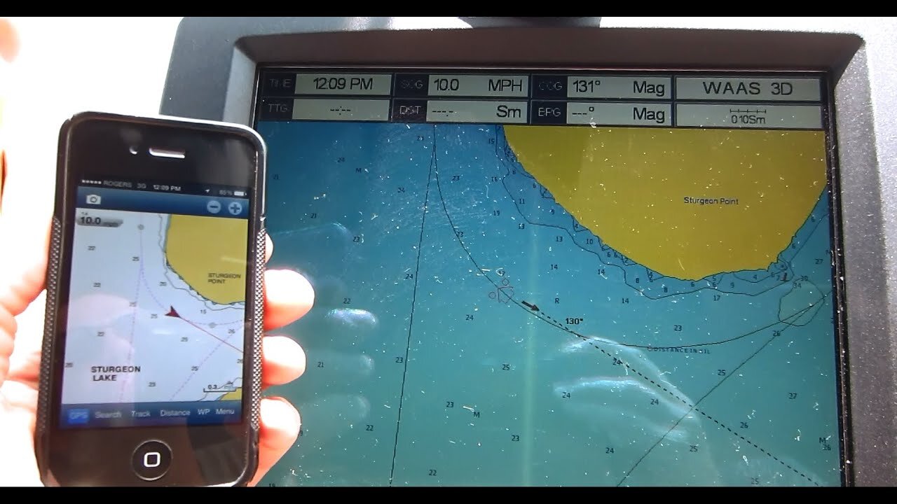
But I’m afraid the advent of GPS is a bigger threat. Of course it is a technical marvel and in many ways it makes our lives much easier and safer. But it is also turning us into navigational dunces and, worse still, it is encouraging us to turn our backs on the world around us.
Unlike every other animal, and unlike our own ancestors, we no longer have to open our eyes to find our way. We hardly even have to think. We are becoming entirely passive consumers of the navigational information effortlessly supplied to us by our little glowing screens.
As we lose the ability to navigate using our senses and wits, we are becoming more and more detached from nature and ignorant of our place in it. This is not - in my view - a healthy development.
...
So much for us humans. Let me turn now to how other animals navigate using the sun, moon and stars, starting with insects.
We have a much better grasp of how insects navigate than any other animals - apart from ourselves. What’s more, insects - for all their diminutive size and correspondingly tiny brains - are remarkably good at it.
They have of course had a head start over us humans - they have been around for hundreds of millions of years!
Among the best studied insect navigators are ants and bees.
One of the earliest serious students of ant behaviour was the polymathic British banker and politician, Sir John Lubbock, who kept colonies of ants at his country house just down the road from his friend Charles Darwin. Weekend visitors would be treated to a tour of these colonies.
In the 1870s he made a discovery that attracted little notice at the time. When testing how ants found their way back to their nest he noticed that the position of the lights he was using to illuminate his work had an effect on which way they headed. Though he was too cautious a scientist to make any large claims on the basis of this slender piece of evidence, Lubbock suspected that his ants might be using the position of the sun to help them set their homeward course.
Some years later, in the early 1900s, an eccentric Swiss doctor working among the native people in a remote corner of southern Tunisia began to take an interest in the local desert ants.
These remarkable animals live in a harsh and featureless environment and go on long foraging journeys, zigzagging around until they find some food to take back to their nest. Though the entrance of their nest is nothing more than a small hole in the ground and there are no landmarks to guide them, the ants can nevertheless head straight for it - even from quite long distances.
Santschi was fascinated by this behaviour and asked a simple question: how did they maintain such a straight course? It’s not clear whether he knew of Lubbock’s work, but Santshci wondered whether they were using the sun as a compass.
To test this hypothesis he conducted a simple but elegant experiment. First he hid the sun from the ants with a screen and then he presented them with its image from the opposite direction - reflected in a mirror. Sure enough, the ants altered course accordingly.
This was the first clear evidence that any non-human animal employed a sun compass. But because Santschi’s results were published in an obscure Swiss journal they passed without notice at the time.
Not much later, in 1919, the famous Austrian biologist Karl von Frisch made one of the most extraordinary discoveries in the history of the behavioural sciences.
Von Frisch was training honey bees to visit an artificial source of nectar (actually just sugar solution) and noticed that when it ran out they would periodically come back to see if the feeder had been replenished. That was intriguing but then he discovered something much more surprising.
As soon as the nectar supply was topped up and one bee from a hive had visited it, other bees from the same hive would quickly start to arrive in large numbers.
How did they know that it was now worth making the journey?
Von Frisch then noticed that the returning scouts - which he had marked with dots of paint when they were at the feeder - performed a curious dance on the vertical face of the honey comb, waggling their abdomens and running around in circles or figures of eight. The other bees excitedly turned towards them and touched them with their antennae. Then they all started heading off towards the feeder.
Von Frisch naturally thought the recruits must be following one of the scouts but that turned out not to be the case.
He then wondered if smell was they key. Perhaps the bees, alerted to the existence of a food supply, were locating its source by following some kind of scent trail.
So next he trained bees to feed from dishes on surfaces soaked with strong scents that would be picked up on their feet and bodies. Their fellow workers would be sure to detect these smells when these scouts returned to the hive.
The ‘recruited’ bees did indeed show a strong preference for feeders marked with these scents. So Von Frisch concluded that they located the new food supply simply by searching for the source of the scent on the dancer’s body.
That bees could alert each other to the existence of an attractive food source was surprising but this was just the beginning. Even more exciting discoveries were to follow.
In 1944, when von Frisch’s home and laboratory in Munich had been destroyed by Allied bombs he took refuge at his lakeside country estate, not far from Salzburg. During the course of that summer, he made a discovery that completely upset his previous ideas.
When scouts returned to their hive from a distant food supply that was marked with a particular scent, ‘recruits’ would often fly directly to it – even if that meant bypassing a much nearer feeder marked with exactly the same scent.
So it was clear that the recruits were not merely searching for any food source that smelt right: they were actively seeking out a distant source and ignoring one that was closer to home.
It appeared that the scouts’ dances conveyed information, not only about the existence of a food source, but also its bearing and distance from the hive!
The bees were in fact sharing precise navigational information with each other. This was truly astounding.
And that was not all. Later von Frisch discovered that the orientation of the waggle dance performed by bees returning from a feeding station gradually altered over the course of the day – in line with the changing position of the sun. The dance direction in fact reflected the relationship between the direction of the food source and the sun’s gradually altering position in the sky.
As Von Frisch himself said, the honey bee was the gift that kept on giving.
He next placed a bee hive in a hut and found that when sunlight was excluded from it, the returning scouts were completely disoriented. But if he showed them a flashlight, they would direct their dances as if it was actually the sun.
The bees could even orient their dances correctly when all they could see was a tiny circle of clear blue sky through a stove pipe installed in the roof of the hut.
When von Frisch discussed these baffling findings with physicist colleagues, they came up with a possible explanation. They suggested that the bees might be sensitive to the polarisation of sunlight.
Since we are unable to detect the polarisation of light with our unaided eyes this is a bit hard to explain. But let me have a go.
The light from the sun is composed of electric and magnetic waves that oscillate at right angles to the direction in which the light is travelling. These electric and magnetic oscillations radiate from the light wave at every possible angle - or plane of polarisation. Sunlight is therefore unpolarised.
But as sunlight passes through the atmosphere it is filtered by the air it encounters. The atmosphere mainly allows through light polarised in one particular plane. This results in the appearance of a strong pattern of polarisation in the sky above us. With the help of polarising filters, we can get a rough idea of what it looks like to animals that are sensitive to polarised light.
If you stand with your back to the sun on a cloudless day, wearing polarising sunglasses and look up at the sky overhead, you will see a dark-blue bar running left to right, from horizon to horizon. If you then turn slowly 90 degrees, either to the left or right, you can see the dark bar gradually lighten. That dark bar marks the region of highest polarisation, and its orientation in the sky is determined by the position of the sun.
Von Frisch realised that if the bees could see these patterns, they would not need to observe the sun itself: they would be able to infer its position from them. So a view of the sky through a stove pipe would perhaps be enough to enable them to orient themselves.
And this he was soon able to prove, with the help of polarising filters.
The discovery that honey bees could detect polarisation patterns in the sky, and steer by them when the sun itself was invisible, was a major breakthrough, but simply knowing the sun’s bearing does not enable animals to maintain a straight course – or at least not for very long.
Somehow - like the Pacific Islanders - they must compensate for the sun’s constant movement across the sky. And that means keeping track of time.
Was it possible that, on top of all their other amazing talents, honey bees might also have an in-built clock?
The short answer is ‘yes’. In the 1950s von Frisch conducted some very ingenious field experiments that demonstrated the ability of bees to make allowances for the movement of the sun during the course of the day.
This was the first demonstration of what is known as a ‘time-compensated’ sun compass in any animal - though a similar ability was discovered in birds at around the same time.
But it would be odd if bees were the only insects to have these abilities and soon they were found in other species.
A dedicated German scientist called Rüdiger Wehner has spent the last 50 years or so studying the desert ant. I was lucky enough to interview him in his apartment in Zurich.
Wehner first saw one of these ants in the Tunisian desert not far from where Santschi had studied them many years earlier. One of these long-legged insects was dashing around under the broiling sun in search of food and eventually seized the remains of a dead fly.
Like Santschi - of whose work he was then unaware - Wehner was amazed to see that it then ran straight back to its nest which was more than 100 metres away.
If honeybees had access to a sun compass based on polarised light it seemed likely that the ants (which are quite closely related) were using the same system, though nobody knew. And how such a system actually worked – even in bees – was still a mystery.
Wehner started tracking the ants across the baking sands using a cunningly contrived wheeled frame, which held a variety of different light filters above them as they ran around.
With its help, Wehner established that their homing abilities did indeed depend on their sensitivity to polarised light.
Back in the laboratory, using an electron microscope, Wehner located a patch of cells along the upper (dorsal) edge of the ant’s eye, which seemed perfectly designed to respond to light of this kind.
Wehner showed that this ‘dorsal rim area’ (DRA) was not only the key to the ant’s ability to detect polarised light, but also the basis of a time-compensated sun compass.
This discovery was a major breakthrough. Almost every insect since examined has turned out to have a system for detecting polarised light. The DRA is in fact the standard insect compass.
There is a great deal more to the desert ant navigation system than a time-compensated sun- compass but you’ll have to wait for my new book to find out more about that!
Let me now turn to another truly extraordinary insect - the best known butterfly in North America - the monarch.
These insects are astonishing migrants. They spend the winters clustered in vast numbers on trees in a tiny area of mountains in central Mexico - the location of which was only discovered by scientists in the 1970s.
When the days lengthen in the spring, the butterflies get sexually excited and rise up in vast numbers. After a mating frenzy, the females stream northwards and lay their eggs on milkweed plants in the southern US. They then die but their caterpillars hatch, feed and eventually a new
generation of adults emerges and heads further north, where the same process is renewed - again and again.
When heading north, the monarchs have a relatively straightforward navigational challenge. They need only find the milkweed plants and lay their eggs. But at the end of the summer, in response to the shortening days, the last brood of adult butterflies (the fourth or even fifth) heads south to Mexico. Some of them will be in Canada when they start out on their long trek. They may fly as much as 3,600 kilometres over a period of seventy-five days – roughly fifty kilometres a day.
But these butterflies have never made the journey before and there is no one to show them the way.
It is hard to imagine how such a feat is possible, but a series of remarkable discoveries over the last twenty years have given us many of the answers.
Drawing her inspiration from the earlier work of von Frisch and Wehner, Sandra Perez decided in the 1990s to find out whether the monarch, like the honey bee and desert ant, made use of a sun compass.
She kept a group of monarchs in a room, where the lights were turned on and off to simulate a day starting and finishing six hours later than the natural day - a process known as ‘clock-shifting’. In effect they persuaded the butterflies that the sun would rise six hours later than it actually did.
Perez and her energetic colleagues then released the butterflies one by one and estimated their preferred migratory heading with the help of hand-bearing compasses while running alongside them. They found that the clock-shifted butterflies generally headed in a west-north-westerly direction, while other butterflies that had not been clock-shifted followed the normal south-westerly course.
In other words the clock-shifted butterflies followed courses that would have made sense if the position of the sun itself had been shifted forward by six hours. This was exactly what was to be expected if the butterflies were using a sun compass.
Some years later, Henrik Mouritsen and his colleague Barrie Frost found a way of tethering the butterflies in a kind of flight simulator, which allowed them to monitor and record their heading accurately for as much as four hours at a time. This was much more accurate than Perez’s technique.
There was a notion that the monarch’s migratory abilities might not only involve a sun compass but also some way of determining their position.
To test this idea, Mouritsen and Frost tried physically displacing butterflies from one side of Canada to the other to see whether they would adjust their heading in response to the change in longitude.
It turns out there are limits even to the monarch’s navigational skills. They could not compensate for the displacement, so it looks as if they only have a compass.
Steve Reppert and his colleagues have since explored the physiological basis of the monarch’s navigational abilities. They have shown that the monarch responds not only to the position of the sun in the sky, but also, like the honeybee and desert ant, to light polarisation. It also has a clock built into its antennae.
This is already an extraordinarily complex and sophisticated system, but there may be yet another dimension to it. It is possible that the monarch is also a magnetic navigator. But again that is another story!
One last major puzzle remains. While the various mechanisms I have described may well enable the butterflies to get within a few hundred kilometres of their final destination, it is still unclear how they pinpoint their overwintering sites in the Mexican mountains.
One possibility is that in the closing stages of their journey, the butterflies home in on some kind of olfactory beacon, perhaps even the smell of the corpses of their dead brethren that cover the ground in their highland refuges.
The annual migration of the North American monarch is one of the most remarkable of all natural wonders, but it is one that future generations may never have the chance to witness. Not only are the forests in which the insects overwinter shrinking, as a result of illegal logging, but there are many other threats to the butterflies – including the profligate use of insecticides and herbicides that are either killing them directly, or destroying the food-plants on which they depend. So time may be running short for scientists to fill in the last piece of this extraordinary puzzle.
So far I have concentrated on how insects use the sun, but some of them are, of course, nocturnal. Take for example certain dung beetles - also known as scarabs.
Over the last twenty years, Eric Warrant and his colleague, Marie Dacke, have conducted a succession of fascinating experiments on nocturnal dung beetle navigation.
Dung beetles are in the recycling business and, but for them, we’d be buried in the stuff. Most of them consume the dung where they find it, but some species do something quite odd. They carve out a chunk, model it into a ball and roll it away as fast as they can - either to eat it themselves or lay their eggs in it.
Making a quick getaway from the dung heap is important because these beetles are very competitive. One beetle will rob another of its ball of dung if it gets half a chance. If the beetles fail to go straight they may well circle back and then get mugged.
For the ancient Egyptians these ball-rolling scarabs were a symbol of the god Khepri who rolled the ball of the sun across the sky, and images of scarabs feature frequently in their art. There’s a spectacularly large example in the BM, which though stylised is extremely accurate anatomically.
Warrant first heard about the ball-rolling scarabs at a conference in South Africa. The speaker said: It’s amazing, they just roll their balls in straight lines all the time and I don’t know how.
Warrant - who is an expert on insect vision - was sitting in the audience thinking excitedly, I know, I know: they must be using polarised light!
He and Marie Dacke later showed that just as bees and desert ants use the polarised light of the sun during the day, dung beetles rely - at least in part - on polarised moonlight!
This discovery caused a big stir, and was published in the leading scientific journal, Nature.
But Warrant and Dacke had a surprise in store. Some years later the two scientists were in camp on a brilliantly clear night at the edge of the Kalahari Desert. The velvet-black sky was filled with stars and they were waiting for the moon to rise, so that they could start a new experiment.
Then the beetles began flying in. To their astonishment they not only started making balls but also rolling them away in perfectly straight lines. But there was no moon!
Warrant and Dacke were really alarmed: perhaps they had got it all wrong.
But then a thought struck the two of them: there was a big bright stripe of light across the sky. The Milky Way! Could the beetles be using that?
To test this new idea, Warrant and Dacke started by attaching little cardboard hats to the beetles, to prevent them seeing the sky.
The insects then had much more trouble steering a straight course. But when transparent plastic hats were substituted for the cardboard ones, they managed perfectly well again, so it was plainly not the mere encumbrance of a hat that was putting them off their stride.
The beetles did indeed need to see the starry sky to maintain a straight course.
Warrant and Dacke next took the beetles to a planetarium where they could manipulate what they could see in the artificial sky projected above them.
It turned out that their ball-rolling performance was only a little worse when they could see the full starry sky, with the Milky Way, than when they could see the moon.
So it was plain that - in the absence of the moon - the beetles really were relying on the Milky Way to set their course.
‘This finding...provides the first documented use of the Milky Way for orientation in the animal kingdom.’ (Dacke.)
...
Let me now turn briefly to birds.
Migratory birds in particular face some formidable navigational challenges.
Arctic terns fly as much as 90,000 km in the course of a single year as they fly from one end the world to another, enjoying a permanent summer.
The bar tailed godwits that breed in Alaska can fly nonstop for a week or more as they traverse the entire Pacific Ocean on their way to New Zealand. 10,000 km flying without a break. By the time they arrive they will have lost a third of their body weight.
Closer to home the swallows that nest in England spend the winter in central Africa where they often roost not just in the same tree but on the very same branch year after year. Such a level of navigational accuracy matches that of GPS.
Sophisticated tracking devices can now tell us a great deal about where birds go and when, but finding out how they find their way much more difficult. 100 years and more of research has revealed that avian navigation is a very complicated business!
In the late 1950s, Franz Sauer had the bright idea of testing how indigo buntings reacted to the patterns of stars presented in a planetarium. He showed that they could make good use of them but it was the American scientist Stephen Emlen who worked out exactly how they did so.
Emlen invented a device to determine which way migratory birds want to fly. In essence it is a funnel-shaped cage with an ink-pad at its base and paper lining the sides. It is called - guess what? - an Emlen funnel.
Migratory birds get very restless when changes in the day length tell them it is time to travel. If you place them in cage they try to escape in their preferred migratory direction. Since their feet are inky they leave marks on the sides of the funnel that show which way they want to go. Not very sophisticated but quite effective.
Using this device Emlen was able to confirm Sauer’s findings - and added much more detail.
He showed that migratory buntings do not pay attention to individual star but rather rely on their ability to detect the rotational pattern of stars that marks the position of true north.
Perhaps surprisingly the exact arrangement of stars does not bother them. Emlen showed that if the birds are shown a night sky that rotates around Betelgeuse – a bright star in the constellation Orion – rather than Polaris, they are completely unfazed and set their course accordingly.
Such a system makes good sense because Polaris has not always occupied the position in the sky that it has today. So the only reliable cue in the long-term is not an individual star but the rotational pattern itself.
Many other birds that migrate by night find true north in the same way. The great advantage of such a system is that, once learned, it is simple to use and, unlike the sun compass, requires no form of time-compensation.
But one mystery remains. It is still not clear how birds learn to recognise these patterns in the night sky. It is hard to believe that they can perceive the rotational movement of the stars, as it is so slow, but they may be able to infer it by comparing ‘snapshots’ of the sky at intervals during the night.
Finally there is one major puzzle to which we don’t yet have a clear answer.
It seems that some migratory birds can tell when they have been shifted east or west. In other words they seem to have solved the longitude problem!
Kaspar Thorup displaced white-crowned sparrows on migration from one side of the US to the other...the adults adjusted, but juveniles didn’t. But how is that possible? Thorup could not explain it.
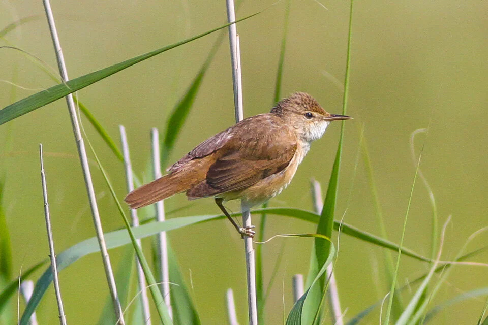
A very recent series of studies suggest that migratory reed warblers too can detect a large east-west displacement.
Russian scientists working on the Baltic coast have shown that adult reed warblers transported to a point near Moscow while migrating in a north-westerly direction can compensate for the shift.
What is more the birds can do so even when they are not physically moved, but are simply exposed to an altered magnetic field that matches a location hundreds of miles to the east or west.
It has long been known that birds have a magnetic compass sense. But a compass can’t tell you where you are, so something else must be going on.
It looks as if these warblers may make use a combination of celestial and magnetic cues to determine where they are ... but that’s another story!
...
We humans think we’re pretty wonderful, don’t we? Looking at the world through the lens of our own special interests it is easy to convince ourselves that we are superior to every other species on the planet.
What other animal can match our genius? We have the most amazingly elaborate languages, we make and build the extraordinary things, we can plan for the future and seem to dominate the planet. And of course that view has received powerful religious endorsement.
After all, what did God tell Adam and Eve?
‘Be fruitful, and multiply, and replenish the earth, and subdue it: and have dominion over the fish of the sea, and over the fowl of the air, and over every living thing that moveth upon the earth.’
Darwin of course put the cat among the pigeons and since then it has become clear that almost every skill once regarded as uniquely human is shared by some other animal.
No longer can we claim to be the only tool users, or the only animals that use language, the only animals capable of recognising themselves in a mirror... the list goes on and on!
And the old behaviourist belief that animals don’t think but merely respond automatically to reward and punishment has long since been demolished. Plenty of other animals can think, have feelings, make plans, and communicate complex ideas. Now we also know that even the smallest of them can navigate with extraordinary skill.
The only thing that really sets us apart is our ability to change the face of the planet - for better or for worse. And it is all too clear which way things are going. The almost infinitely complex web of life to which we belong - and on which we depend - is in now grave danger.
What I take from my study of animal navigation is a heightened awareness of the astonishing natural wonders that surround us, and a growing sense of alarm about what the future holds. Our own fate and that of our world now lies in our own hands - how can we possibly stand by and let the planet burn? There is no time to be wasted. We must take steps to protect the world we inhabit and the extraordinary creatures with which we share it - and we must do so NOW.
End
